Selhausen
The research center Juelich (IBG3: Agrosphere) currently operates 6 climate/eddy covariance stations within the TERENO observatory “Eifel/Lower Rhine Valley”. Three of these stations (Selhausen, Rollesbroich and Wüstebach) are part of the ICOS infrastructure.
The Selhausen site represents the heterogeneous agricultural rural area of the lower Rhine valley. The climate is temperate maritime with a mean annual temperature of 10°C and annual precipitation of 700 mm for the period from 1961 to 2014 (meteorological tower, Forschungszentrum Jülich).
The most important crops in the region of Selhausen are sugar beet (Beta vulgaris), winter wheat (Triticum aestivum), winter barley (Hordeum vulgare), maize (Zea mays) and rape seed (Brassica napus). Only parts of the region are managed as grasslands. The underlying Quaternary sediments are mostly fluvial deposits covered with loess. Major soil types are luvisols and gleyed cambisols, partly with large contents of gravel. The land surface is generally flat with slopes up to 4° in the area of a former channel of the Rur river system.
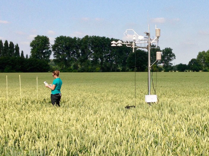
Since 2007, Selhausen region served repeatedly as a survey site for several measurement campaigns. During these campaigns ground based measurements and remote sensing methods were used to observe the exchange of water, energy and carbon dioxide between the soil, plant canopies and the atmosphere. From 2007 to 2010 a first long term eddy covariance study was conducted within the Selhausen region, but unfortunately the field is no longer accessible (measurements can be found at the European fluxes database cluster, ID: DE-Seh). In spring 2011 a new, relatively large field (9.7 ha) for long term eddy covariance measurements was found about 500 m away from the former site. In the phase from 2011 to end of 2015 the station (50.865°N, 6.447°E, 203m a.s.l.) was equipped with a CSAT3 sonic anemometer and LI7500 gas analyser. Besides flux measurements and typical climate parameters (radiation, air temperature, air humidity, soil moisture, soil temperature etc.), also the phenological development of the crops and farming activities were recorded. The complete modification of the station according to ICOS Level-1 sites is scheduled for the end of 2015, with a consecutive phase of parallel measurements with the old anemometer / gas analyzer.
In short distance to the field many additional long term measurements were carried out. At a lysimeter site around 400 m away, the water cycle is studied, a rhyzotron at the same place allows to observe the root growth of crops and active and passive microwave remote sensing methods are conducted to study near surface soil moisture.
Regularly updated data of the site can be achieved at the following address:
teodoor.icg.kfa-juelich.de/ibg3searchportal/index.jsp
Publications referring to the Selhausen study site
Mauder, M., Cuntz, M., Drüe, C., Graf, A., Rebmann, C., Schmid, HP., Schmidt, M., Steinbrecher, R., 2012. A strategy for quality and uncertainty assessment of long-term eddy-covariance measurements. Agricultural and Forest Meteorology 169, 122-135, 2013.
Schmidt, M., Reichenau, T.G., Fiener, P., Schneider, K., 2012. The carbon budget of a winter wheat field: An eddy covariance analysis of seasonal and inter-annual variability. Agricultural and Forest Meteorology 165: 114.
Langensiepen, M., M. Kupisch, A. Graf, M. Schmidt, F. Ewert, 2014: Improving the stem heat balance method for determining sap-flow in wheat. Agricultural and Forest Meteorology, 186, 34-42.
Eder, F., Schmidt, M., Damian, T., Träumner, K., Mauder, M., 2015: Meso-scale eddies affect near-surface turbulent exchange: evidence from lidar and tower measurements. Journal of Applied Meteorology and Climatology, 54, 189-206.